


Racurs Automates the Processing of Drone-based Imagery into Photogrammetric Products
Новости
ТАСС. МЭР: РФ готова экспортировать решения в области спутникового мониторинга Земли
Виктор Адров: Celebrating 25 Years of Photogrammetry Software Innovation. GIM International
Eric van Rees. Photogrammetry: A changing discipline. SPAR3D
Взгляд с обложки. Интервью В.Н. Адрова журналу GIM International.
Опубликована статья Гордона Петри Now a Major Photogrammetric Systems Supplier. A Visit to Racurs
Дата: 13 ноября 2018
Тип публикации: сми о нас
 Eric Van Rees, November 13, Commercial UAV News
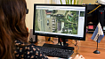
Today, drones equipped with lightweight aerial cameras are used for capturing aerial imagery and are creating real differences on projects of all types. These images serve as the basis for different photogrammetric products, ranging from 2D maps to 3D models, and they’re opening up brand new opportunities thanks to hardware and software developments that have enabled the creation of new deliverables, resulting in higher accuracies and a faster turnaround.
When professional drones were introduced some years ago, they were immediately adopted by the photogrammetric community for capturing aerial images. Unmanned drones with lightweight digital cameras provided a cheaper alternative to aerial surveys with manned aircraft, especially for small-scale mapping projects. Photogrammetrists immediately started experimenting and developing cost-effective solutions for specific use cases, but the difference the technology can make is something that’s being taken to a whole new level thanks to software that was on display at the “From Imagery to Digital Reality: Earth Remote Sensing and Photogrammetry” event.